A web-based GIS decision support system for slope stability monitoring data interpretations and visualisation management

|
Authors: Firman, AB; Wiratno, CD; Bahri, S; Timbul, H Paper is not available for download Contact Us |
DOI https://doi.org/10.36487/ACG_rep/1308_50_Syamsul
Cite As:
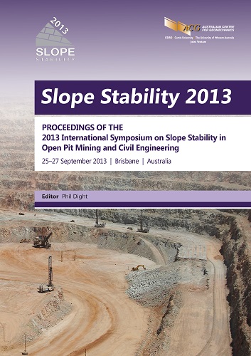
Firman, AB, Wiratno, CD, Bahri, S & Timbul, H 2013, 'A web-based GIS decision support system for slope stability monitoring data interpretations and visualisation management', in PM Dight (ed.), Slope Stability 2013: Proceedings of the 2013 International Symposium on Slope Stability in Open Pit Mining and Civil Engineering, Australian Centre for Geomechanics, Perth, pp. 749-762, https://doi.org/10.36487/ACG_rep/1308_50_Syamsul
Abstract:
This paper illustrates how the application of web-based Geographic Information Systems (GIS) to store and visualise the slope monitoring data performed by Robotic Total Station (RTS) and Slope Stability Radar (SSR) into an interactive map on the web. Since 2004 PT Adaro Indonesia has been developing an advanced slope monitoring system to monitor slope stability of its open pit mines. As one of the world’s largest, with a mining area of nearly 45,000 hectares, PT Adaro’s single open pit mine boasts of 13 RTS’s supported by 800 active monitoring prisms scattered throughout the mine area. Later in 2009, SSR Groundprobe was developed to complement the automatic monitoring system already in place. Nowadays there are two SSRs (SSR SSR X–089 and XT–135) that monitor movement on the specific pit slopes of concern. From the results of the automatic slope monitoring system performed by RTS and SSR, the information is taken as the value of the movement that occurs in each respective area or waste dump. If the movement of a slope exceeds a predetermined trigger level, then it can be taken in the form of changes in mine design controlling evacuation or any type of work (including the mining activity) done in the affected area to avoid the risk of equipment damage caused by a catastrophe, such as landslide. For long term purposes, data from the RTS and SSR can be used as supporting data for further Geotechnical analysis to get an overview of the characteristics of a slope in a particular area. Database management of large amounts of data from the continuous monitoring slope movements by the RTS and the SSR, presents frequently occurring obstacles that needs special attention. One challenge lies in the presentation in real time mode since previous data should not be ignored as they depict sustainability. From the data can be easily managed using the SQL (Structured Query Language) server-based Leica GeoMos software that is capable of managing unlimited amount of data, and if necessary do the query, analysis, and database modifications via the SQL server enterprise software. Another challenge is the SSR data management, where data is managed manually using wall folders that have limitations of just 2 weeks, and can only be performed exclusively using SSR Control software. To overcome these obstacles, one effective way is to develop a GIS database for organising slope monitoring data. In order to deliver slope monitoring data in a more effective and interactive, a web-based GIS applications can also be developed. With this WebGIS, mine slope stability monitoring information can be easily and quickly accessed because it is web based, and that publishing can be done in both intranet and internet. Customising the menu interface and the data to be displayed is very flexible and fit the needs of the users. Furthermore, RTS data stored in SQL Server can be used in creating interactive thematic maps through the application of Esri ArcGIS and the open-source software MapServer. As for the SSR data, georeferencing still needs to be done first so that the data has a value of 3D position in order to do spatial analysis in ArcGIS software and can be visualised real time and interactively on WebGIS using Mapserver.
References:
Apaphant, P., Chantawarangul, K., Mairaing, W. and Suwanwiwattana, P. (2001) The Development of Geotechnical Database of Bangkok Subsoil using GRASS-GIS, 22nd Asian Conference on Remote Sensing, 5–9 November 2001, Singapore, 3 p.
Bahri, S. (2006) Geodetic Monitoring Systems Untuk Survey Deformasi Slope Pada Areal Tambang Terbuka, Forum Ilmiah Terbuka Ikatan Surveyor Indonesia, 119 p.
Brimicombe, A. (2003) GIS, environmental modelling and engineering, Taylor & Francis, 312 p.
Bye, A. (2009) Going Deeper: Deeper Open Pits, International Mining October 2009, viewed 20 April 2013, .
Chao, D., Chowdhury, S., Froese, C.R., Kim, T.H., Martin, C.D., Morgan, A.J. and Lan, H.X. (2009) A web-based GIS for managing and assessing landslide data for the town of Peace River, Canada, Natural Hazards and Earth System Sciences, pp. 1433–1435.
Lan, H. and Martin, C.D. (2007) A digital approach for integrating geotechnical data and stability analyses, Rock Mechanics: Meeting Society’s Challenges and Demands, pp. 45–52.
Osasan, S.K. and Afeni, T.B. (2010) Review of slope monitoring techniques, Journal of Mining Science, Vol. 46, No. 2, pp. 177–186.
© Copyright 2026, Australian Centre for Geomechanics (ACG), The University of Western Australia. All rights reserved.
View copyright/legal information
Please direct any queries or error reports to repository-acg@uwa.edu.au
View copyright/legal information
Please direct any queries or error reports to repository-acg@uwa.edu.au