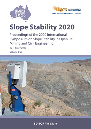
Use of laser scanner technology as part of the slope stability risk management strategy at Letšeng diamond mine

|
Authors: Lefu, N; Nokwe, V |
DOI https://doi.org/10.36487/ACG_repo/2025_11
Cite As:
Lefu, N & Nokwe, V 2020, 'Use of laser scanner technology as part of the slope stability risk management strategy at Letšeng diamond mine', in PM Dight (ed.), Slope Stability 2020: Proceedings of the 2020 International Symposium on Slope Stability in Open Pit Mining and Civil Engineering, Australian Centre for Geomechanics, Perth, pp. 241-254, https://doi.org/10.36487/ACG_repo/2025_11
Abstract:
The stability of slopes in open pit mines is an issue of great concern because of the detrimental consequences that instabilities can cause. Therefore, stringent systematic slope stability assessment and risk management are imperative to ensure the safe and continuous economic operation of these mines. Laser scanning technology is the most advanced method in geodesy and emerged as an indispensable tool in open pit data collection, interpretation and analysis. In 2018, Letšeng acquired a Maptek XR3 laser scanner for volumetric surveys, geological and geotechnical data collection and analysis, as well as tactical and strategic slope deformation monitoring. Letšeng diamond open pit mine is the highest altitude diamond mine in the world at around 3,100 m above sea level, where two kimberlite pipes are mined as successive pushbacks. The mine is in the northern region of Lesotho, within the Drakensberg Formation of the Karoo Supergroup. The article discusses the use of the laser scanning method as part of a slope stability management strategy at Letšeng. The first part discusses geological and geotechnical data collection, detailed structural analysis and detection of potentially unstable rock masses on the pit slope. The second part discusses slope reconciliation and slope deformation monitoring.
Keywords: laser scanning, slope stability, risk management
References:
Abellan, A, Jaboyedoff, M, Oppikofer, T & Vilaplana, JM 2009, ‘Detection of millimetric deformation using terrestrial laser scanner: experiment and application to a rockfall event’, Natural Hazards and Earth System Sciences, vol. 9, 365–372.
Barton, N & Bandis, S 1982, ‘Effects of Block size on the Shear Behaviour of Jointed Rock’, Proceedings of the 23rd Symposium on Rock Mechanics, American Institute of Mining, Metallurgy & Petroleum Engineers, New York, pp. 739–760.
Bazarnik, M 2018, ‘Slope stability monitoring in open pit mines using 3D terrestrial laser scanning’, Proceedings of the 4th International Conference on Applied Geophysics, vol. 66,
Beraldin, JA 2004, ‘Integration of laser scanning and close range photogrammetry – the last decade and beyond’, in O Altan (ed.), Proceedings of the XXth ISPRS Congress, International Society for Photogrammetry and Remote Sensing, pp. 972–983
Bohler, W & Marbs, A 2002, ‘3D scanning instruments’, Proceedings of the CIPA WG 6 International Workshop on Scanning for Cultural Heritage Recording, ZITI, Thessaloniki, pp. 9–18.
Bowen, D, Ferraris, RD, Palmer, CE & Ward, JD 2009, ‘On the unusual characteristics of the diamonds from Letseng-la-terae kimberlites, Lesotho’, Lithos, vol. 112, pp. 767–774, 10.1016/j.lithos.2009.04.026
Buckley, SJ, Howell, JA, Enge HD & Kurz, TH 2008, ‘Terrestrial laser scanning in Geology: data acquisition, processing and accuracy considerations’, Journal of the Geological Society, vol. 165, issue 3, pp. 625–638.
Bye, AR & Bell, FG 2001, ‘Stability assessment and slope design at Sandsloot open pit, South Africa’, International Journal of Rock Mechanics and Mining Sciences, vol. 38, pp. 449–466.
Hetman, CM, Smith, BS, Robey, J, Nkotsi, T, Mohapi, M & Mohapi, T 2018, ‘Letšeng diamond mine, Lesotho: a variant of Kimberley-type pyroclastic kimberlite emplacement’, Mineralogy and Petrology, vol. 112, issue 2, pp. 365–382.
International Society for Rock Mechanics 1978, ‘Suggested methods for the quantitative description of discontinuities in the rock masses’, International Journal of Rock Mechanics and Mining Sciences & Geomechanics Abstracts, vol. 15, pp. 219–368.
Maptek 2020a, Maptek PointStudio, computer software, https://www.maptek.com/products/pointstudio/index.html
Maptek 2020b, Maptek Sentry, computer software, https://www.maptek.com/products/sentry/index.html
Nguyen, HT, Fernandez-Steeger, TM, Wiatr, T, Rodrigues, D & Azzam, R 2011, ‘Use of terrestrial laser scanning for engineering geological applications on volcanic rock slopes – an example from Madeira island (Portugal)’, Natural Hazards and Earth System Sciences, vol. 11, pp. 807–817.
Oppikofer, T, Jaboyedoff, M, Blikra, L, Derron, MH & Metzger, R 2009, ‘Characterization and monitoring of Aknesusisng terrestrial laser scanning’, Natural Hazards and Earth System Sciences, vol. 9, 633–653.
Parisean, WG 2006, Design Analysis in Rock Mechanics, Taylor & Francis, Leiden.
Priest, SD 1993, Discontinuity analysis for Rock Engineering, Chapman and Hall, London.
Rosser, NJ, Petly, DN, Lim, M, Dunning, SA & Allison, RJ 2005, ‘Terrestrial laser scanning for monitoring the process hard rock coastal cliff erosion’, Quarterly Journal of Engineering Geology and Hydrogeology, vol. 38, pp. 363–375.
Scott Smith, BH, Nowicki, TE, Russell, JK, Webb, KJ, Mitchell, RH, Hetman, CM… & Robey, JvA 2013, ‘Kimberlite Terminology and Classification’, Proceedings of the 10th International Kimberlite Conference, vol. 2, pp. 1–17.
Slob, S, Hack, V, van Knapen, B, Turner, K & Kemeny, JM 2005, ‘A method for automated discontinuity analysis of rock slopes with 3D laser scanning’, Proceedings of the Transportation Research Board 84th Annual Meeting, Transportation Research Board, Washington DC, pp. 187-194
Slob, S & Hack, R 2004, ‘3D terrestrial laser scanning as a new field measurement and monitoring technique’, in R Hack, R Azzam & R Charlie (eds), Engineering Geology for Infrastructure Planning in Europe, Springer, Berlin, 10.1007/978-3-540-39918-6_22
Stanley, JR, Flowers, RM & Bell, DR 2015, ‘Erosion patterns and mantle sources of topographic change across the Southern African Plateau derived from the shallow and deep records of kimberlites’, Geochemistry, Geophysics, Geosystems, vol. 16, issue 9, pp. 3235–3256,
Strang, DR 2010, Engineering geological characterisation and slope stability assessment of Whitehall Quarry, MSc Thesis, University of Canterbury, Waikato.
Sturzenegger, M & Stead, D 2009, ‘Close-range terrestrial digital photogrammetry and terrestrial laser scanning for discontinuity characterisation on rock cuts’, Engineering Geology, vol. 106, issue 3–4, pp. 163–182,
© Copyright 2026, Australian Centre for Geomechanics (ACG), The University of Western Australia. All rights reserved.
View copyright/legal information
Please direct any queries or error reports to repository-acg@uwa.edu.au
View copyright/legal information
Please direct any queries or error reports to repository-acg@uwa.edu.au
