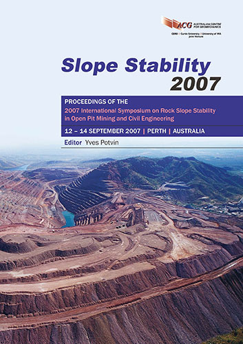
Monitoring Landslide Movement and Triggering Factors in Near Real-Time - Examples from Translational Landslides in New Zealand

|
Authors: Massey, CI; Palmer, N Paper is not available for download Contact Us |
DOI https://doi.org/10.36487/ACG_repo/708_29
Cite As:
Massey, CI & Palmer, N 2007, 'Monitoring Landslide Movement and Triggering Factors in Near Real-Time - Examples from Translational Landslides in New Zealand', in Y Potvin (ed.), Slope Stability 2007: Proceedings of the 2007 International Symposium on Rock Slope Stability in Open Pit Mining and Civil Engineering, Australian Centre for Geomechanics, Perth, pp. 439-447, https://doi.org/10.36487/ACG_repo/708_29
Abstract:
The Taihape landslide covers approximately 45 hectares and contains over 200 households a primary school and a hospital. The Waikorora landslide covers approximately 6 hectares and is traversed by the Maui gas pipeline, which provides New Zealand with 80% of its gas requirements. Both landslides are currently active and are being monitored using a combination of field mapping, sub-surface investigation and near real-time monitoring of rainfall, ground-shaking intensity, groundwater levels and surface movement. Data from the landslides are being used to correlate different rates of surface movement to the triggering factors enabling movement triggering thresholds to be established. Until 2006, monitoring was carried out manually, with the monitoring frequency ranging from twice a year to once every five years. New monitoring equipment operating in a near real-time framework was installed in 2006. A key component are the surface movement monitoring systems which, at Taihape, comprises a laser survey network that automatically tracks, at defined (hourly) intervals, the positions of reflectors placed on the landslide; and at Waikorora, a series of continuous GPS receivers installed on the active landslide. These movement data, along with data from piezometers, rain gauges and strong motion accelerographs installed on the landslides are transmitted by radio and internet to a central hub where they can be viewed in near real-time. The greater temporal and spatial resolution of the monitoring networks allow movement triggering intensity/duration thresholds to be developed, which will allow alert levels, based on landslide movement to be set, once a better understanding of the movement patterns have been established.
References:
Allison, R.J. and Brunsden, D. (1990) Some mudslide movement patterns. Earth Surface Processes and Landforms.
15 (4). pp. 297-311.
Chan, R.K.S., Pank, P.L.R. and Pun, W.K. (2003) Recent developments in landslip warning system in Hong Kong. In
proceedings of the 14th Southeast Asian Geotechnical Conference, Lisse, Holland. Published, A.A. Balkema.
Cole, K., and Davis, G.M. (2002) Landslide warning and emergency planning systems in West Dorset, England. In
McInnes, R.G. and Jakeways, J., eds., Instability, planning and management, London. Thomas Telford.
Flentje, P.N., Chowdhury, R.N., Tobin, P. and Brizga, V. (2007) Towards real-time landslide risk management in an
urban area. In Press.
Hodgson, P. (2002) Gas Sector Review – Paper 3: Open Access to the Maui Pipeline. New Zealand Government
Cabinet Paper, Minister of Energy, Ministry of Economic Development, New Zealand.
Keefer, D.K., Wilson, R.C., Mark, R.K.,Brabb, E.E., III, Ellen, S.D., Harp, E.L., Wieczorek, G.F., Alger, C.S. and
Zatkin, R.S. (1987) Real-time landslide warning during heavy rainfall. Science 238 (13). pp. 921-925.
Massey, C.I. (2006) Waikorora Bluff landslide, North Taranaki Movement Monitoring Report, May 2006 to December
2006. GNS Science client report CR 2007/34.
NOAA-USGS. (2005) Debris flow warning system. Circular 1283. US Department for the interior. US Geological
Survey.
Petley, D.N., Bulmer, M.H.K. and Murphy, W. (2002). Patterns of movement in rotational and translational landslides.
Geology. 30 (8). pp. 719-722.
Petley, D.N., Mantovani, F., Bulmer, M.N. and Zannoni, A. (2004) The use of surface monitoring data for the
interpretation of landslide movement patterns. Geomorphology. 66 (1-4) pp. 133-147.
Thompson, R.C. (1982) Relationship of geology to slope failures in soft rocks of the Taihape-Mangweka area, Central
North Island, New Zealand. PhD Thesis, University of Auckland.
Tonkin & Taylor Ltd. (2005) West Taihape landslip – EQC Claim 2005/3768, Site investigation and assessment of
active toe area. Unpublished report for Earthquake Commission, NZ.
Williams, K., Johnson, D. and Rogers, N. (2007) Ongoing movement of the West Taihape landslip, New Zealand (in
press).
Rock Slope Stability
Slope Stability 2007, Perth, Australia 447
© Copyright 2026, Australian Centre for Geomechanics (ACG), The University of Western Australia. All rights reserved.
View copyright/legal information
Please direct any queries or error reports to repository-acg@uwa.edu.au
View copyright/legal information
Please direct any queries or error reports to repository-acg@uwa.edu.au